GPSFileDepot.com
 

News:

Welcome to GPSFileDepot!

Main Menu
Menu

Show posts

This section allows you to view all posts made by this member. Note that you can only see posts made in areas you currently have access to.

Show posts Menu

Topics - Boyd

#41
Very impressive update. Garmin has certainly been listening to users. I have not tried this yet myself, so install with care since it's beta. One user in Garmin's forum's reported some issues after installing. See this thread in Garmin's forum for lots of screenshots and explanations of the new features.

https://forums.garmin.com/showthread.php?t=24413

QuoteBaseCamp 3.3 is here! We are starting off with an early Beta release to give everyone a chance to check out the new features and pound on it for a little bit before we release the final version.

Download it here: http://developer.garmin.com/apps/BC/BaseCamp_3.3.0.2_Beta.exe.

We have incorporated a lot of user requests from this very forum. If your desired feature/bug fix didn't make it into this release, don't hesitate to remind us.

[COLOR="DarkOrange"]We are very interested in your feedback, please report bugs and oddities you find, and comment on the new features.[/COLOR]

This is the change-list from 3.2.2 to 3.3.0.2. I will add some explanations and screen-shots in later posts.


  • Added collapsible list folders and sub-lists for improved organization.
  • Added shaping point support for zumo devices like done in MapSource.
  • Added explicit support for shaping points.  These will be transferred to supporting devices.
  • Added support for transfer of waypoint categories on supporting devices.  These are displayed in BaseCamp as lists.
  • Added more activity profiles, with improved activity routing on supported maps.
  • Added specific avoidances for various road classes, removed the road selection slider.
  • Added custom activity profiles.
  • Added keyboard short-cuts for editing tools (divide, insert, erase).
  • Added a tools menu for easier discovery of tool keyboard shortcuts.
  • Changed to make GPX files on a memory card directly editable.
  • Changed to read all GPX files on a memory card, similar to how devices behave.
  • Improved graphing of track data.
  • Improved graphing when multiple routes or tracks are selected.
  • Improved layout of geotagged photo, waypoint, route, and track properties.
  • Added additional statistics to route and track properties.
  • Added 'Center on map' check-box on route and track dialogs.
  • Added an easier way to add waypoints to routes (Insert Waypoint button).
  • Added additional data fields to waypoints (such as address and phone number).
  • Added display and updating of date last modified for waypoints.
  • Added display of lists that contain this data item to properties.
  • Added receiving geocache visits from devices.
  • Added logging geocache visits on OpenCaching.com.
  • Added printing of geocaches.
  • Added alternate notification mechanism (less annoying pop-ups).
  • Added display settings to adjust width of routes and tracks.
  • Added support for importing waypoints and tracks from KML/KMZ files.
  • Added suggested file name when exporting (so it isn't always 'untitled').
  • Added more map details for higher detail setting.
  • Added data filters to map view.
  • Added preserving the dialog size for each data type.
  • Added option to reset track's altitude to map data.
  • Added functionality to remember display feature settings per profile.
  • Changed 'Remove List and Contents' to 'Remove list and unique contents'.
  • Added Shift-Delete short-cut for 'Remove list and unique contents'.
  • Improved printing of routes and tracks.
  • Fixed issues with sending routes to the zumo.
  • Fixed elevation profile labels for Windows XP (no longer invisible).
  • Fixed issue when duplicating a route. BaseCamp will now also duplicate the waypoints in that route.
  • Fixed issue with the data filter not being remembered between application runs.

#42
I was trying to update the info for one of my maps, and no matter what I did the edit would fail with some kind of database error after I hit the submit button. After some screwing around, I *think* the issue was that the title of the map contained an apostrophe (Boyd's Map of New Jersey). In any case, when I removed the apostrophe from the title, the edit was properly submitted.

It's odd, because I didn't change the title of the map, the previous version also had an apostrophe in it. Anyway, kind of trivial but I thought I'd mention it.  :)
#43
Map Making Support / Installer script... again
October 06, 2011, 02:08:36 PM
I'm getting ready to release a new map but got lost somewhere in the various threads about installer issues. Do we think that the current template file in mapmaking tutorial number 8 has resolved the various Windows 7 issues? http://www.gpsfiledepot.com/tools/map_install.zip
#44
GPSr Units / Oregon 450 - $200 at REI thru 9/5
August 30, 2011, 12:43:14 PM
Title pretty much says it all. REI sale price is $250 and there's a $50 mail-in rebate from Garmin. This is by far the lowest price ever on this model. I'm embarrassed to admit what I paid for my Oregon 400t about 3 years ago. But you could buy Oregon's for the whole family for about the same price at this sale.  ;D
#45
General Discussion / Re: Upload
July 28, 2011, 06:24:49 AM
This isn't related to the upload process, but here's a utility that claims to install .gmapi files on Windows (also does a lot of other handy things). I didn't realize that was possible! If true, maybe it would allow us to start offering downloads in a universal format that doesn't require messing with the Windows registry. http://www.javawa.nl/gmtk_en.htm

QuoteMaps in the new format (not using registry settings) are becoming more common. These maps have the extension .gmap or .gmapi. Sometimes they are presented as maps for Mac OSX (RoadTrip/BaseCamp), but they can be used in Windows too.
Garmin MapManager for the Mac provides an easy way to install them, but there is no Windows version of it.

This option in JaVaWa GMTK enables you to install these maps. It will check that no existing map will be overwritten, and after installing new maps, JaVaWa GMTK will perform a check for possible file errors and conflicts with other maps. Even on the Mac this method is preferable, because Garmin MapManager doesn't check anything and will overwrite existing maps without warning.
#46
General Discussion / USGS "US Topo" project
June 29, 2011, 01:40:02 PM
Has anyone else looked at these yet? http://nationalmap.gov/ustopo/index.html

I have tried downloading 3 different quads and cannot open any of them. They are packaged as .zip files but 7-zip, Windows and Globalmapper all say the archive cannot be opened. I tried download from both here:

http://store.usgs.gov/b2c_usgs/usgs/maplocator/(xcm=r3standardpitrex_prd&layout=6_1_61_48&uiarea=2&ctype=areaDetails&carea=%24ROOT)/.do

And here:

http://viewer.nationalmap.gov/viewer/

But had the same problems. BTW, the new national map viewer (link above) seems to be to be very nice. Faster and easier to use than the old one.
#47
http://garmin.blogs.com/my_weblog/2011/05/the-ultimate-in-touchscreen-toughness-garmin-montana-gives-new-meaning-to-rugged-and-versatile.html

https://buy.garmin.com/shop/shop.do?cID=&pID=75228

Wow, now this is cool.... but really expensive (650t is $700, no pricing yet on the others but probably around $600 without the pre-loaded 100k topo). Dual orientation 4" screen at  480x272, dual power options and finally a handheld with a speaker so this can replace your auto gps.


#49
Using The Maps/Garmin Software / Mapsource Weblinks
February 15, 2011, 03:46:05 PM
Have not tried this yet myself, but it looks very interesting: http://www.javawa.nl/weblinkcreator_en.html

There are some examples here: http://www.javawa.nl/weblinks.html#en
#50
I posted elsewhere about using Filemaker Pro to process New Jersey landcover data for a project I'm working on. I want to expand this map to neighboring states, but there just isn't any high resolution landcover data available for Pennsylvania or New York. The only thing I could find was 250k historical USGS LULC from the 70's and 80's.

But the National Landcover Database has relatively high res data (30m per pixel) from 2001 in raster format where the colors correspond to codes (see: http://www.mrlc.gov/). The problem is, how to get the raster data into shapefiles without a really tedious workflow or purchasing expensive software? I found a way to do this using Mapwel, and I thought I'd post here in case it helps someone else. If you know a better way to do this, please share!

First, I downloaded the NLCD imagery from the link on the site above. I then opened the file and exported small tiles (~1500x1500 pixels) as GeoTiff files. These can be imported into Mapwel with one click.


I then used the magic wand (trace) tool and clicked on each of the different colors to vectorize them. There are several settings to play with in the magic wand control panel, and some trial and error is needed to get the best results. But after that, it's pretty straightforward - I just clicked on each of the colors in the image (there are about 16), gave them names and let the software trace the outlines. I named the areas with the hex codes of the custom types I would use later in Globalmapper.


The results were then exported as a .mp file and opened in Globalmapper to massage the data. In Globalmapper I searched for each of the names given to the polygons and assigned the correct MP_TYPE values to them. Seems like there's probably an easier way to do this, but I didn't find it.


After getting all the correct MP_TYPE's assigned, I combined the landcover with the other layers of my map, exported as a .mp file and compiled with cgpsmapper. My custom type file is the secret sauce that makes it all work in Mapsource. :)


This technique should work with any kind of raster data that uses color codes to represent values. If you just want to produce simple, green forest shading, that would be easy to do from the NLCD  since you'd only need to vector three different colors (for Deciduous, Evergreen and Mixed forest).

Mapwel also has a one-click auto-vectorizer and I played with that also. It creates a lot of polygons, and I didn't like the pixellation so much. The Magic Wand tool has a setting to create curved polygons.

I have the advanced version of Mapwel, but I believe the free download may do all of this as well. The free version won't send a fully processed map to a GPS, but it will let you save files on your computer. I'm not certain whether it allows the export of .mp files however. Regardless, you can experiment with the magic wand tool in the free version and see if it looks useful.

Here are a couple screenshots from the Nuvi 3790 along with the North America DEM file.

#51
GPSr Units / Oregon 450 now $270 at Bass Pro
November 18, 2010, 03:50:06 PM
Lowest price we've seen on this unit since the big REI Labor Day sale at $250. Looks like a good deal on what is arguably the top handheld on the market: http://www.basspro.com/webapp/wcs/stores/servlet/Product_10151_-1_10001_10205401_425002001_425000000_425002000?cmCat=CROSSSELL_THUMBNAIL
#52
Saw this suggested elsewhere, and it sounded like a good idea. Instead of the trick of installing Training Center and then Mapsource, you could install BaseCamp first, then Mapsource. I think BaseCamp also includes the crude basemap and Mapsource should see that when installed.

This would make a little more sense IMO, since most people will find BaseCamp more useful than Training Center. I don't have a "clean" machine handy to try this on myself at the moment, but seems like it would work.
#53
When it comes to GIS data, if I can't open a file in GlobalMapper then I'm pretty clueless. So maybe somebody can set me straight on how to accomplish this. The search/replace function in Globalmapper is very powerful, but still awkward for processing large amounts of data. I am very experienced in developing databases using FileMaker Pro, so I'd like to use it to massage a large amount of Land Use/Landcover data that I have downloaded from my state's GIS website.

For example, I downloaded the following:

http://www.nj.gov/dep/gis/digidownload/zips/lulc07/w07lu07.zip

and ended up with these files:

w07lu07.xml
w07lu07.txt
w07lu07.shx
w07lu07.shp.xml
w07lu07.shp
w07lu07.sbx
w07lu07.sbn
w07lu07.prj
w07lu07.htm
w07lu07.dbf
revised.doc

I imported w07lu07.dbf into Filemaker with no problem. After massaging the data, I can easily export it back out as a .dbf file. But then what? Normally I would just load the shapefile into Globalmapper (w07lu07.shp) and discard all those other files. How do I associate the modified .dbf file with the shape data in the .shp file? I am going to add a few more fields to the database (such as a Garmin polygon type - eg: 0x50)

My goal is to be able to import a bunch of files like this, run a filemaker script to assign Garmin polygon types to each record, open the file for further editing in GlobalMapper, then export it out as an .mp file to compile in cgpsmapper.

Can somebody point me in the right direction? :)
#54
General Discussion / GPSies
October 02, 2010, 09:56:56 AM
Hadn't seen this before. Looks like a good resource to find tracks to add trails to your maps: http://www.gpsies.com

The Find Coordinates tab seems to do a nice job. And you can choose Google/Yahoo/Microsoft/OSM map displays.
#55
This just appeared on Garmin's support site. I'm surprised to see that they are actually considering relaxing the size restrictions on "custom map" (raster image) format.

https://forums.garmin.com/showthread.php?t=10396

Quote from: TRAILTECHWe are excited about the continued interest and adoption of Garmin Custom Maps by Garmin customers.  We are evaluating the performance impact of increasing the maximum tile size and overall tile count.  If these improvements can be achieved, our limits may be raised.  However, structural differences in the file format between Garmin Custom Maps (KMZ) and Garmin BirdsEye (JNX) will prevent Custom Maps limits to ever reach the overall capacity of Garmin BirdsEye.


Thanks,

TrailTech
#56
Map Making Support / End of cgpsmapper?
June 29, 2010, 10:21:38 AM
See: http://www.cgpsmapper.com/download/Readme0100.txt

QuoteVersion 100 is expected to be the final and last version of cGPSmapper program,
no further development is expected - only bug fixes.
Support will be provided till end of 2010
#57
I have been working on a personal project to map the little trails on my land, and learned something in the process which might be of interest. Many of you have read the tutorial here, specifically the comments on page 23 about map resolution: http://cgpsmapper.com/download/GM8DocV2.pdf

Quote'24' refers to the precision of the latitude and longitude coordinates provided for the object. When declaring the location of objects in the world, the highest precision available uses 24 bits of resolution, which resolves to an accuracy of about 2.5 meters. Consumer GPS units have a best-case accuracy of about 8 meters.

In another thread here, somebody questioned the math that lead to the 2.5 meter figure. I am not sure how the calculation was performed, but the following screenshot will graphically demonstrate it. Using GlobalMapper, 1 foot per pixel aerial imagery, and track points accumlated from many walks on my little trails, I created my map. The points on the polylines are quite close together in some cases - one or two feet apart. I exported the map as a .mp file and then opened it in GlobalMapper again, overlaid on the original. In the image below, the pink lines are the original and the blue lines are the .mp file.


So you can see that the actual coordinates have been rounded off to 24 bit numbers, creating stair steps. Right away it became obvious that I wouldn't be able to make the kind of map I wanted using Garmin's vector format. Now granted, this detail is beyond the accuracy I can expect from my Oregon anyway... but I still wanted to make my map!

The solution was simple; I created a "custom map" (raster image) as a .kmz file. I had overlaid my vector data on 1 foot per pixel aerial imagery, so I just exported everything as a .kmz file in the proper format for the Oregon. But the results still weren't quite what I had hoped for. At close zoom settings, the lines looked too jaggy. So I re-sampled everything at 4 inches per pixel and exported again. This produced a very nice looking map with smooth lines even at extreme zoom levels.


You may not ever want to create a map at this resolution, but if you do then it's nice to know that the 2.5m/24 bit limit does not apply to "custom maps". Of course, you will need an Oregon, Dakota, Colorado, GPSMap 78 or 62 to use this kind of map.
#58
GPSr Units / "Map Themes" on Nuvi 3700 series
June 24, 2010, 07:06:33 PM
The new 3700 series Nuvi's have a menu for "map themes" which evidently allows you to pick different color schemes. I wonder how this is being implemented? One simple way would be to allow a choice of different .typ files within the mapset.
#59
GPSr Units / New 3700 series Nuvi's from Garmin
April 19, 2010, 11:46:57 AM
A pretty obvious attempt to copy the iPhone design, but these new models look pretty interesting. They have finally done one thing I've been hoping for - the unit has an accelerometer and switches automatically between landscape and portrait modes (like.... an iPhone :D
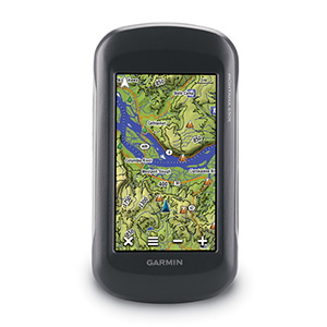
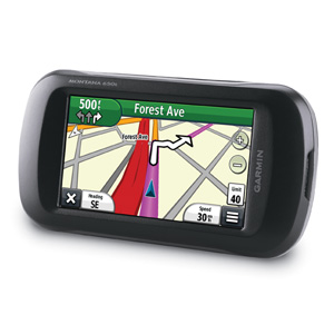
). This could really help make the same unit better suited to handheld and automotive use. And it's funny, because one of their earliest models, the GPS V, could switch between landscape and and portrait modes back in the 1990's.

But based on my experiences with the Nuvi 1350 (one of their most recent models), topo maps may not fare so well. I guess we will need to wait a few months to find out....

http://www.gpsreview.net/garmin-nuvi-3700-series-3750-3760t-3790t/


#60
General Discussion / Where did cgpsmapper go?
March 11, 2010, 07:15:20 PM
Just now I got the following:

QuoteAddress Not Found
Firefox can't find the server at www.cgpsmapper.com.
The browser could not find the host server for the provided address.

Just a glitch, or something else?