Thanks! Lots of new things are coming to boydsmaps, but such a big re-write that it will take until 2027 to finish. I'm trying to completely re-imagine what a map website should be.
The new version will actually be a unix-like operating system (written "from scratch") that runs right on the webpage, a completely private virtual machine with it's own private filesystem and graphical user interface. On a computer, it has multiple map and data windows that "talk" to each other. Still playing with completely new ideas for the mobile interface.
But it has multiple "tiers", starting with a dead-simple one for people who just want to click on links and look at maps. The most advanced tier has multiple unix-like terminal windows, with standard unix commands plus a suite of new commands for working with maps. Virtually everything is customizable. Lots of fun - tons more work to do - but it's already running on my development machine.
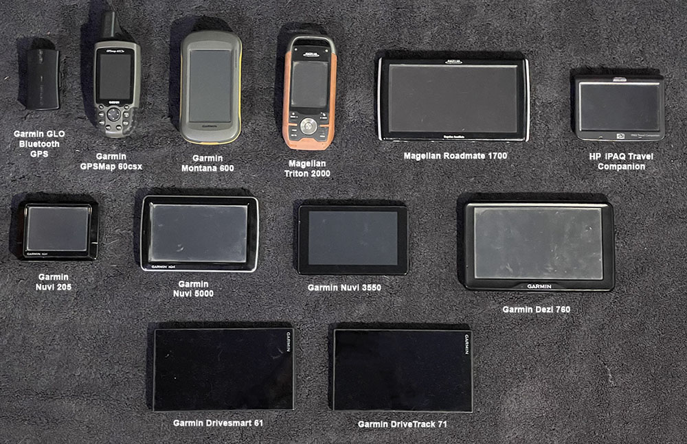
Regarding Garmin, I've spent literally thousands on their devices, starting with a StreetPilot 2620 in 2004 (IIRC) - here are the ones I still have. Gave many other to friends over the years.

You can look way back at my posts on this forum and see how excited I used to be about Garmin. But I just got frustrated, Garmin doesn't want you to make your own maps. For Garmin, a map is nothing but a "profit center". And they simply can't handle the data-rich maps I make (which are no problem on a phone).
But keep making those free maps! It's great there are still people doing that. Lots of people still have old Garmin devices, even if they can't afford new ones ($450 for an eTrex???). I tried firing up my Montana 600 the other day. After it warmed up I got "phantom clicks", opening random menus non-stop like it was posessed, LOL.
I believe this is the classic sign of a failing resistive touch screen.
The new version will actually be a unix-like operating system (written "from scratch") that runs right on the webpage, a completely private virtual machine with it's own private filesystem and graphical user interface. On a computer, it has multiple map and data windows that "talk" to each other. Still playing with completely new ideas for the mobile interface.
But it has multiple "tiers", starting with a dead-simple one for people who just want to click on links and look at maps. The most advanced tier has multiple unix-like terminal windows, with standard unix commands plus a suite of new commands for working with maps. Virtually everything is customizable. Lots of fun - tons more work to do - but it's already running on my development machine.
Regarding Garmin, I've spent literally thousands on their devices, starting with a StreetPilot 2620 in 2004 (IIRC) - here are the ones I still have. Gave many other to friends over the years.

You can look way back at my posts on this forum and see how excited I used to be about Garmin. But I just got frustrated, Garmin doesn't want you to make your own maps. For Garmin, a map is nothing but a "profit center". And they simply can't handle the data-rich maps I make (which are no problem on a phone).
But keep making those free maps! It's great there are still people doing that. Lots of people still have old Garmin devices, even if they can't afford new ones ($450 for an eTrex???). I tried firing up my Montana 600 the other day. After it warmed up I got "phantom clicks", opening random menus non-stop like it was posessed, LOL.
I believe this is the classic sign of a failing resistive touch screen.
)