GPSFileDepot.com
 

News:

Welcome to GPSFileDepot!

Main Menu
Menu

Show posts

This section allows you to view all posts made by this member. Note that you can only see posts made in areas you currently have access to.

Show posts Menu

Messages - marindukenyo

#1
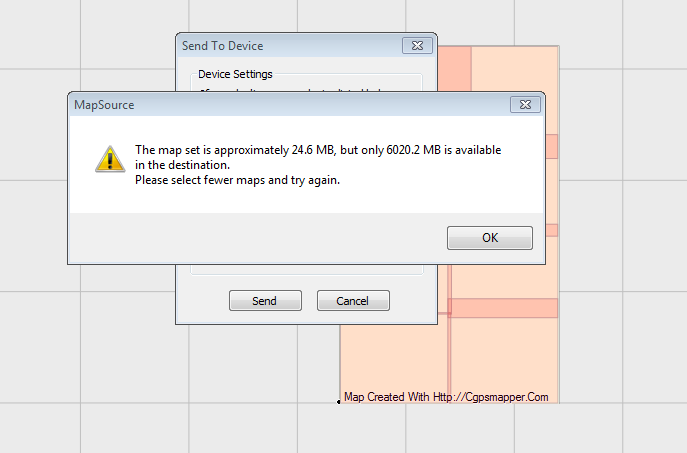
i am trying to load a 24mb map file to my Oregon 550 specifically its 8gig sd card.  so far, the sd card garmin folder contains only 400mb of map files, way below the 2gig limit. yet i get this message every time i try. 

same results using mapsource or mapinstall

is there a runaround to this issue?  help, it's frustrating

#2
Quote from: Seldom on December 20, 2011, 06:36:18 PM
Just tried this with my OR300.  My corresponding number reads 5676 feet.  That's pretty close to my altitude (actually 5720 feet).  Are you 32m above sea level?

yes, 32 meters more or less.

however, there are instances where the satellite page display altimeter does not jive with the elevation contained in other pages of the oregon 550. will be posting photos to better illustrate the point.

btw, do you have issues with your oregon 300 altimeter (like giving readings that's way off the actual altitude/elevation)?

#3
can somebody tell me what this "32 m" item mean? (i added the yellow pointer arrow, not part of the regular display).


#4
newb question:

i know that datum origin markers are benchmarks or reference points and there are plenty worldwide. for example, the luzon datum (philippines) is located on our island.

technically, what are the important roles of datum locations in terms of gps technology?

should i choose "luzon philippines" datum on my gps while working with various way points and tracks within my province? should i choose it for other areas in the country? what is my best bet?