GPSFileDepot.com
 

News:

Welcome to GPSFileDepot!

Main Menu
Menu

Show posts

This section allows you to view all posts made by this member. Note that you can only see posts made in areas you currently have access to.

Show posts Menu

Messages - Boyd

#31
Very cool - nice job!  8)
#32
.img files are "containers" and the contents can be very different. What you have is (apparently) a map file to be used directly on a GPS. This is not the same kind of .img file that you can install in Basecamp. Mapset Toolkit and cgpsmapper cannot do what you want with that file. The map author would need to provide you the correct kind of installable files to actually accomplish what you want.

Alternately, you could copy the map file(s) to USB flash drive and put them in a folder named Garmin. Basecamp would treat that just like a GPS and read the map.

Only other solution I know is a "virtual device", which is directly supported on the Mac but unfortunately not on Windows. See the following discussion of ways to do the same kind of thing on Windows with third party apps

https://www.javawa.nl/virtualdevice.html
#33
General Discussion / Re: Trakmap Quebec Quad
November 06, 2022, 07:09:15 AM
That looks like a commercial product that you have to purchase. You won't find anything like that here, the site has a strict policy against piracy.
#34
Map Making Support / Re: Name of map file on garmin GPS
October 11, 2022, 10:32:50 AM
I am also Mac-based, but I heavily use a Windows 10 virtual machine with Parallels. There just aren't enough mapping/GIS apps on MacOS unfortunately.

Give Basecamp a try. Theoretically, Garmin MapInstall will automatically figure out how to properly bundle maps together for your GPS. In reality, I find it pretty confusing and buggy. But if you already have a gmapsupp.img file that you want to use, not sure if MapInstall can do that (it can with newer devices). Would be best to have all the maps installed in Basecamp, then you can choose the parts you want and send them all to the GPS in one bundle.

I don't think Basecamp/Mapinstall shows the number of segments like Mapsource, but I may have just missed that detail.

Also have a look at GMTK and Device Manager from javawa, they are very nice utilities and were available for both Windows and MacOS. However, I believe they broke in some versions of MacOS (Catalina?) a number of years ago. Unfortunately the author suffered a stroke and had to give up maintaining these programs.

https://www.javawa.nl/gmtk_en.html

Anyway, if they will run on your Mac they may be able to combine maps for you. The device manager program also shows total segments IIRC.
#35
Map Making Support / Re: Name of map file on garmin GPS
October 11, 2022, 04:21:04 AM
Not familiar with the Astro, but it sounds like an older model. You are correct, these old devices only recognize one file named gmapsupp.img. However, with Garmin's older system, .img files are actually "containers" that can hold multiple maps.

I would suggest using Mapsource and not Basecamp with this old GPS, since that was what it was designed for. Read this tutorial carefully and specifically note step #8 that says:

"Repeat steps 2 through 7 for any other maps you want to load at the same time"

That is the key - you have to select portions of ALL the maps you want before sending them to the GPS. This will cause them to all be bundled into a single gpmapsupp.img file.

https://www.gpsfiledepot.com/tutorials/how-to-load-maps-on-my-garmin-gps-unit/#mapsource

However, this part of your post suggests you could have a problem.

"The map file is big and covers the whole country"

Maps are made from smaller "tiles" or "segments" and these old devices are very limited in that respect. They can only accept about 1000 segments total. If you send more, some of the maps will not work properly. Impossible to generalize, because it depends on your specific maps. However, you cannot exceed the segment limit.

I gave up on Garmin awhile ago and no longer have Mapsource installed, but IIRC you will see the total number of segments at the bottom left of the window, underneath the list of tiles you have chosen. Keep an eye on that as you select areas on the map and make sure it does not exceed 1000.

The segment limit has nothing to do with the size of the file, it is completely different. You will probably hit the limit long before the 4gb filesize limit of the FAT32 filesystem.
#36
GPSr Units / Re: Garmin GPS Map 60cx not seeing maps
September 21, 2022, 11:36:40 AM
Oh well, you certainly tried. Honestly, you're not missing much there. I know the 60c(s)x has its fans, but IMO it's day has long passed. Very limited mapping capability (2000 tile limit), no raster imagery, tiny low resolution screen, slow processor, 8-bit color, awkward pushbutton interface.

I loved mine back in 2006, but got the first Oregon in 2008 and it was so much more capable. The good things about the 60 series is that the screen is very readable in bright light without a backlight, so you get good battery life. The SirfStar chipset is also still pretty respectable as for accuracy, aided by the quad helix external antenna.

Anyway, certainly sounds like something is wrong. Maybe somebody else will come along with another idea?
#37
Maps can contain POI, but that is completely different from what Basecamp considers "data". They cannot contain waypoints in Garmin's system, those are a form of user data that you create or load separately.

Search the map to find any included POI. I think some map authors here have included .gpx files along with their maps, not sure if that's the case with what you downloaded however.
#38
Not familiar with what you downloaded, however maps and data are two different things in Basecamp. Data would be things like waypoints, tracks and routes. These would have to be imported separately info Basecamp - for example, from your GPS.

So, unless the package you downloaded included a separate file (such as a .gpx file) and you imported it, then data will be blank. After you import data into Basecamp, it will always be there, regardless of the map you are using.
#39
GPSr Units / Re: Garmin GPS Map 60cx not seeing maps
September 19, 2022, 10:47:07 AM
Yes, a card that is too big or has files that are too big would be a problem. However, the OP says these same maps/cards work on his Montana 600. That should rule out the file size issue, since it also uses the FAT32 Filesystem.

You have probably done this, but just in case.... are you sure the map you want is enabled (and any other maps disabled)? See page 45 of the owners manual

https://static.garmin.com/pumac/GPSMAP60CSx_OwnersManual.pdf

Also look at the card info, as shown on page 69 of the manual. That should confirm whether the device actually "sees" the card and detects a map on it.

Problems with the contacts and the microSD card were not unheard of on the 60csx, which would prevent the card from being recognized.
#40
GPSr Units / Re: Garmin GPS Map 60cx not seeing maps
September 17, 2022, 11:43:17 AM
Yes, the 60csx is a bit of an antique these days (have had one myself since around 2006). It will only recognize one map file named gpmapsupp.img and it must be in a folder named Garmin. The Montana doesn't care what the map file is named, as long as it has a .img extension. So, re-name one of your maps gmapsupp.img and see if that works.

Since it can only have one map file, if you want multiple maps on the 60csx, they must all be bundled into the same gmapsupp.img file. MapInstall is supposed to figure this out automatically if you use it, but I don't trust it, LOL.

I would only use Mapsource, Garmin's older software with the 60csx. There are tutorials on this site for getting and using it if you don't already have a copy. Just realize, your City Navigator and Bluecharts maps may not work on the 60csx, depending on exactly what maps you purchased. The DVD and download versions of City Navigator become locked to the first GPS they are installed on. The version that Garmin sells on memory cards can be used in multiple devices, but the cards are copy protected so they can't be duplicated.
#41
Map Making Support / Re: Map colors on GPS device
September 15, 2022, 11:20:43 AM
Just realized that you are talking about a DriveTrack 70 (an older model) and I have the newer DriveTrack 71. I would not expect that to matter, but perhaps it does?

Here's my map of New Jersey, it works on my DriveTrack 71, DriveSmart 61, Dezl 760 and several Nuvi devices. I'd be surprised if it doesn't work on your DriveTrack 70. I discontinued this map last year but am bringing it back for a limited time since there still seems to be some interest.

Anyway, see if it works for you. The documentation is pretty thorough and there are several different .typ files and map themes enclosed for customizing the appearance. They might point you in the right direction. Just be aware, I take some liberties with Garmin road types, so that could be confusing.

If you want to look at these, let me know after you have downloaded them. I will be deleting these files soon and will not offer them again.

Mac Version for installation in Basecamp:

https://boydsmaps.com/download/nj2018mac.zip


Windows Version for installation in Basecamp and Mapsource:

https://boydsmaps.com/download/nj2018win.zip


File Version for direct installation on the GPS only:

https://boydsmaps.com/download/nj2018gps.zip


#42
Map Making Support / Re: Map colors on GPS device
August 22, 2022, 06:31:07 AM
You could also play around with map themes, they are just little files that you put on the GPS. No need to re-compile your map

https://www.pinns.co.uk/osm/theme_editor.html

Should go without saying... if you are going to mess with files on the GPS, make sure you have a good backup first. And on a similar note, with the DriveTrack, you really need a backup of any Birdseye imagery. Garmin has effectively "orphaned" this device by discontinuing Birdseye.
#43
Map Making Support / Re: Map colors on GPS device
August 21, 2022, 04:42:29 PM
Wow, I thought I was the only person in the world with a DriveTrack 70!  ;D

I have used several of my own maps on mine and it has no problem recognizing a standard Garmin .typ file. So I suspect the problem is MapWell. It has been many years since I used it, but they were doing something very strange and non-standard to customize the map appearance. IIRC, they inserted a separate .typ file in each map tile (segment). I had problems with this back in the days when I had a Nuvi device.

IIRC, you can export an .mp file from Mapwel. You could then re-compile it with cgpsmapper and use a standard .typ file.  You could then use typviewer to customize the appearance. That was my favorite .typ file editor (back when I was still making Garmin maps).

https://sites.google.com/site/sherco40/

The DriveTrack and othe recent Garmin devices also can use Garmin "map themes" (.kmtf files) to customize map appearance. These can over-ride what your .typ file is doing, so it gets rather confusing.

You would need to do a Google search to learn more about these, it's been too long since I made one. But they can be created/modified with a text editor. You will find some examples if you look in the Themes folder on your DriveTrack.
#44
Map Making Support / Re: Experiments with LIDAR
July 24, 2022, 01:50:52 PM
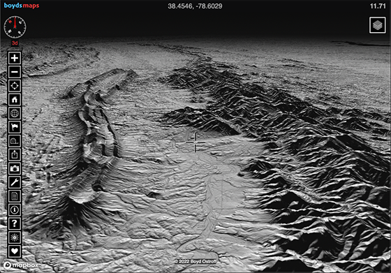
Quote from: Boyd on June 07, 2022, 11:45:24 AM
Am planning to expand the map to a much larger area later this summer.

The new, expanded map is now available! This is the new coverage area - over twice the size of the original map, more than 600 gb with almost 22 million map tiles!  8)


Here's Shenandoah, Virginia in 3d

https://boydsmaps.com/#11.71/38.454567/-78.602919/mbx3dmidatl/40.20/73.20


3d view of the Catskills

https://boydsmaps.com/#14.00/41.998428/-74.386694/mbx3dmidatl/-174.00/72.00

This is how it looks on a phone.


You can view the 3d map in 2d North-up mode if you prefer - just click the compass to toggle between 2d/3d. But there's a separate 2d version of the same map without the elevation data if you aren't interested in 3d views, it loads much faster (note that 3d maps appear in blue text in the map menu)

Here's the 2d map of Martha's Vineyard, for example.

https://boydsmaps.com/#11.71/41.398941/-70.647387/midatlidar/0.00/0.00


I would like to continue expanding this map to cover an even larger area in the future. I still have over 200gb free disk space on the server but need to find the best use for it. Ultimately, I'll need to lease additional disk space to support future expansion.

It's not practical to create a map this large in one piece, so I divide it into smaller blocks of 100gb to 150gb of uncompressed 32-bit floating point DEM data. After processing this, I end up with blocks of a few hundred thousand .png map tiles which are ~1/4 the size of the source files. Then there is a companion set of .png tiles that contain the elevation data in Mapbox RGB format. The elevation tiles only use about half the space of the map tiles.

Before creating the RGB tiles, the geoTIFF DEM source file must be processed with Mapbox rasterio, which is a rather complex command-line program

https://blog.mapbox.com/rasterio-gdal-especially-for-python-programmers-553dabf7dd71

This encodes the DEM data as a .tif raster image which can be exported as .png map tiles. It took awhile to figure out exactly how to do all of this, Mapbox does not really support creating your own RGB DEM, they expect you to use their own pre-packaged DEM. But their DEM is about 5-meter resolution and I wanted 1-meter DEM. Using their own content can also result in usage charges but it's free to use their API with your own data. But you're pretty much on your own, I could find very little information about how to implement all of this locally but eventually figured it out through trial and error.

I create all the the tiles with Globalmapper using the option to only export fully-covered tiles, this prevents gaps between different blocks of data when I merge them with the full map. Finally, I zip the tiles, upload them to the server and unzip.

There are so many steps to the process and so many different files, I had to create a spreadsheet to track my progress!
#45
You could try Mapsource, Garmin's older software. It was discontinued long ago but still available. Since you already have Basecamp, it should be easy - Mapsource should see the map that you have already installed. See this

https://www.gpsfiledepot.com/tutorials/how-to-install-mapsource-if-it-didnt-come-with-your-gps/

And this

https://www.gpsfiledepot.com/tutorials/how-to-load-maps-on-my-garmin-gps-unit/#mapsource