GPSFileDepot.com
 

News:

Welcome to GPSFileDepot!

Main Menu
Menu

Show posts

This section allows you to view all posts made by this member. Note that you can only see posts made in areas you currently have access to.

Show posts Menu

Messages - drew23

#1
Quote from: Seldom on April 04, 2012, 12:42:13 PM
Do you need turn by turn directions to the hydrants?  If not, it should be trivial to just create a set of hydrants as waypoints or POI and, add them to a NUVI, and have just about the best address search available.  To DIY, you'll need at least the Personal Version of cgpsmapper ($50) or the routable version ($900) and you'll need to figure out how to make a  map that will handle address search.

AFAIK I'm just about the only person on this site who fools around with routable maps, and all the address search data i deal with comes from OpenStreetMap data.  Unfortunately, they've been going through a licensing purge of their database which should make OSM a lot less useful for a while.

1.I have 11,333 Addresses in my address layer that I want to use. This is every address currently in the County. I also have 582 Hydrants. Would this amount of data be too much?

2. My info is in Arcmap, this will work correct?

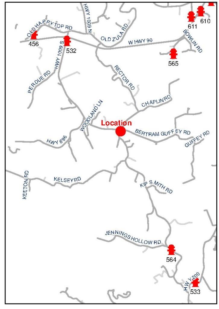
3. Do I need turn by turn on the hydrants? For example: If I was at the location marked in the map below, and asked for the closest hydrant using POI, could it point it out and show me where it was, or do I have to have turn by turn in order to do this?

I apologize for being such a noob.

#2
Thanks for the help everyone. Looked around a little this morning and looked at the 2300LM. Any ideas on that unit? I want to use this for my normal navigation and try to do this little project too, or do I need a dedicated unit to try my project on?

Justin
#3
Boyd, thanks for the invite. Can you explain the process in steps from my data to the garmin.
#4
I was referred to come here off of another forum, here is my post from that forum.

My name is Justin and I currently work for the local water/sewer utility company. I am the person in charge of GIS Mapping of all the utilities. I have access to the new ESRI road and address layers for my area as well as the data I have created. I am using Arcmap 10, and SDImaps to map out the utilities. I would like to buy a GPS(unsure on model I need) that I can create an address, road, and fire hydrant map for use in the Fire trucks and Officer POV vehicles. I have a few questions:

I would like it to work as follows, climb in truck, address search, routing to the address, then set up proximity alarms on the Hydrants to show there location while en route. Once you arrive on scene, the truck that is in charge of hydrant operations could search nearest POI (Hydrant) and go out to get water. We don't have computers in the truck. I thought this would be a great alternative if possible.

1. How Possible is this?
2. Since I have this data, how hard would it be to build this map?
3. Recommended Brand and Model?
4. What software would I need?
5. Can I use my Address and Road layer to build the turn by turn navigation? We have updated address and the current addresses on most GPS units are off by as many as 5-6 houses.

Our County is about 484 Sq. miles of which we provide vehicle extrication to 100% of and Fire protection to about 75% of. We have a new E911 system in which the entire County and City were readdressed and, some of the road/street names changed about 2 years ago. Most of our guys know where the roads are to an extent but it is at times hard to remember exactly.

The main purpose to having this would be to get us headed the right direction and point out hydrants along the way and be able to find the nearest hydrant when looking for a water source.

Thanks,
Justin